Scottish Office Air Photographs Unit (and later bodies)
|
At the end of the Second World War, the Royal Air Force was tasked with undertaking Operation REVUE, to provide the Ordnance Survey with aerial photography of the entire UK. This photography provided a basis for new mapping and informed postwar planning and reconstruction. Several photographic reconnaissance squadrons undertook this work throughout the late 1940s and around 500 sorties were flown over Scotland, resulting in the collection of over 280,000 aerial photographs. Copies of these photographs were held by the Scottish Office in a specially created Air Photograph Library in Edinburgh.
During the 1960s, the Library was renamed the Air Photographs Unit (APU) and was administered by the Scottish Development Department, part of the Scottish Office. It grew significantly with the transfer of Ministry of Defence and Ordnance Survey imagery of Scotland dating from the Second World War onwards.
 |
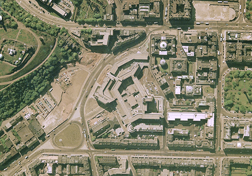
New St Andrews House, Edinburgh. In the mid-1970s, the APU moved into offices here from a basement in York Place. |
The APU commissioned aerial surveys on behalf of the Scottish Development Department and advised the Scottish public-sector on the application of aerial imagery. It also maintained the Central Register of Aerial Photography of Scotland (CRAPS), a register of all known aerial imagery covering the country, mirroring similar services in England and Wales.
As aerial imagery of Scotland flown by the Royal Air Force and Ordnance Survey was declassified and released, batches of roll film and copy prints were transferred to the care of the APU at regular intervals. Staff were then required to catalogue any accompanying finding aids and to manually plot the footprint of each sortie onto a series of One Inch to One Mile overview maps, to allow cover searches to be carried out.
 |
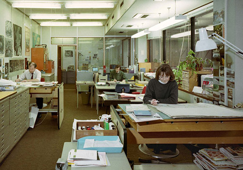
Staff members Gavin Aitchison (Air Photographs Officer), John Hamilton (Administration Assistant) and Jenny Fortune (Draughtsperson) in the APU office at New St Andrews House, Edinburgh, in 1993.
|
Over and above its internal advisory role, the APU serviced a growing number of public enquiries and visitors who wished to view the collection in person. Following an internal government review, and in recognition of its important public service role, in 1993 the APU was transferred to the Royal Commission on the Ancient and Historical Monuments of Scotland (RCAHMS). In 2008, it was merged with The Aerial Reconnaissance Archives to form NCAP, and now includes over 1.5 million aerial images of Scotland.
All of the finding aids to this collection are online and can be viewed with a website subscription.
Collections of oblique aerial photography taken by AeroPictorial Ltd, Aerofilms Ltd and RCAHMS are not held within NCAP and are therefore not hosted on this website. Please visit Canmore to view that imagery.
Sub-Collections
German Air Force: Aerial Reconnaissance (Scotland)
Royal Air Force: Second World War
Royal Air Force: No.1 Camouflage Unit
Royal Air Force: National Air Photograph Survey
Royal Air Force: JARIC (Scotland)

