All Scotland Survey
Following the passage of the Wildlife and Countryside Act (1981), increasing public debate about wider environmental issues had exposed a gap in basic information and knowledge about the scale and nature of changes in land use, land cover and habitats in Scotland. To address this, Professor J T Coppock and Dr R P Kirby of the University of Edinburgh recommended a complete aerial photographic survey of Scotland followed by a land cover analysis. In 1987 the Central Research Unit of the Scottish Development Department commissioned the project, with support from the Nature Conservancy Council, the Forestry Commission and the Countryside Commission for Scotland.
Given the size of the project, two aerial survey companies were eventually contracted to take the photography; Planning & Mapping Ltd and their sub-contractor, JAS Photographic Ltd. Management of the contract and quality control of the resultant aerial photography was entrusted to the University of Edinburgh Department of Geography and, from 1988, Mason Land Surveys Ltd. The Macaulay Land Use Research Institute was tasked with the analysis of the aerial photographs, in order to collect data which would allow appropriate countryside management policies to be developed.
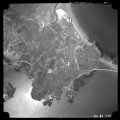
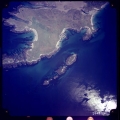
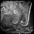
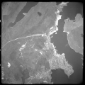
The aerial survey produced contact photographic prints at a uniform scale of 1:24,000, with the majority of Scotland photographed using panchromatic (black-and-white) film, while central Scotland was recorded in natural colour.
The project began in 1987, with cover of the Western Isles and Orkney collected between May and September. During a spell of very good weather in May and June 1988, vast swathes of Scotland were covered, with the remaining gaps covered in 1989. Seventy-one films were exposed during the course of the survey, with over 14,000 photographs taken and subsequently housed in the Scottish Office Air Photographs Unit, in Edinburgh.
The project was a resounding success, aided enormously by some fortuitous weather in 1988. The ensuing dataset produced by the Macaulay Institute was used by environmental agencies to formulate government policy for the next 20 years and the aerial photography provided a baseline record of the land cover of Scotland in the late 1980's, comparable to the National Air Photograph Survey undertaken by the RAF after the Second World War.
The project was not without its twists, however. It was intended that the whole survey would be completed using panchromatic (black and white) film, for several reasons:
- Panchromatic film would give better definition and tonal contrast than colour film
- Panchromatic film and black and white prints were of known durability - colour prints were known to fade quickly
- Panchromatic film could be used to acquire cover in weather conditions which would preclude colour - this was especially important because of the urgency of the task, the size of the area to be covered and the unpredictability of the Scottish weather
- Black and white prints are more suitable for mosaic work - adjacent runs of colour prints taken on different days or colour prints from the same film made at different times often cannot be matched successfully
- Black and white prints would be cheaper to produce
- The Scottish Office Air Photographs Unit had an in-house capability to print black and white prints
After the project had started, one of the contractors offered to take colour photography, although this had not been asked for in the original specification. It then collected colour photography of its designated survey block, an area from Oronsay in the west to Eyemouth in the east and from Glenrothes in the north to East Kilbride in the south. This meant that photography of the most populous area of Scotland, including Edinburgh and Glasgow, could not be printed in-house by the Scottish Office to meet later requirements. The same firm was then given the job of marketing prints from all of the photography acquired during the survey, including the panchromatic films. This meant that all of the rolls of film were retained by the contractor until 1995 when it went into liquidation. The films were then returned to Scottish Government control and are now held by NCAP.
All of the images and finding aids from the All Scotland Survey have now been digitised and can be viewed on our website.


