

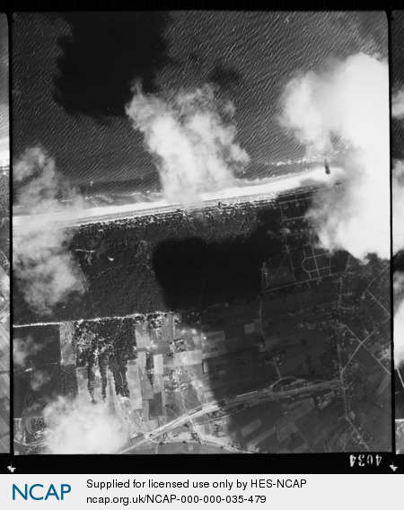
Forst Pudagla; Mecklenburg-Vorpommern; Germany
Subscription required for access to zoomable images
Frame details
Date: 14 August 1944
Location: Forst Pudagla; Mecklenburg-Vorpommern; Germany
Coordinates (lat, lon): 54.083874, 13.906758
Description: Peenemunde Experimental Site This aerial photograph was digitised for the BBC documentary Operation Crossbow.
Location: Forst Pudagla; Mecklenburg-Vorpommern; Germany
Coordinates (lat, lon): 54.083874, 13.906758
Description: Peenemunde Experimental Site This aerial photograph was digitised for the BBC documentary Operation Crossbow.
Image type: Vertical
Scale: 10000
Scale: 10000